1
/
of
2
Amazon
Connecticut State Wall Map - 20.75" x 18.5" (Laminated)
Connecticut State Wall Map - 20.75" x 18.5" (Laminated)
Regular price
$ 30.99 USD
Regular price
$ 30.99 USD
Sale price
$ 30.99 USD
Unit price
/
per
Couldn't load pickup availability
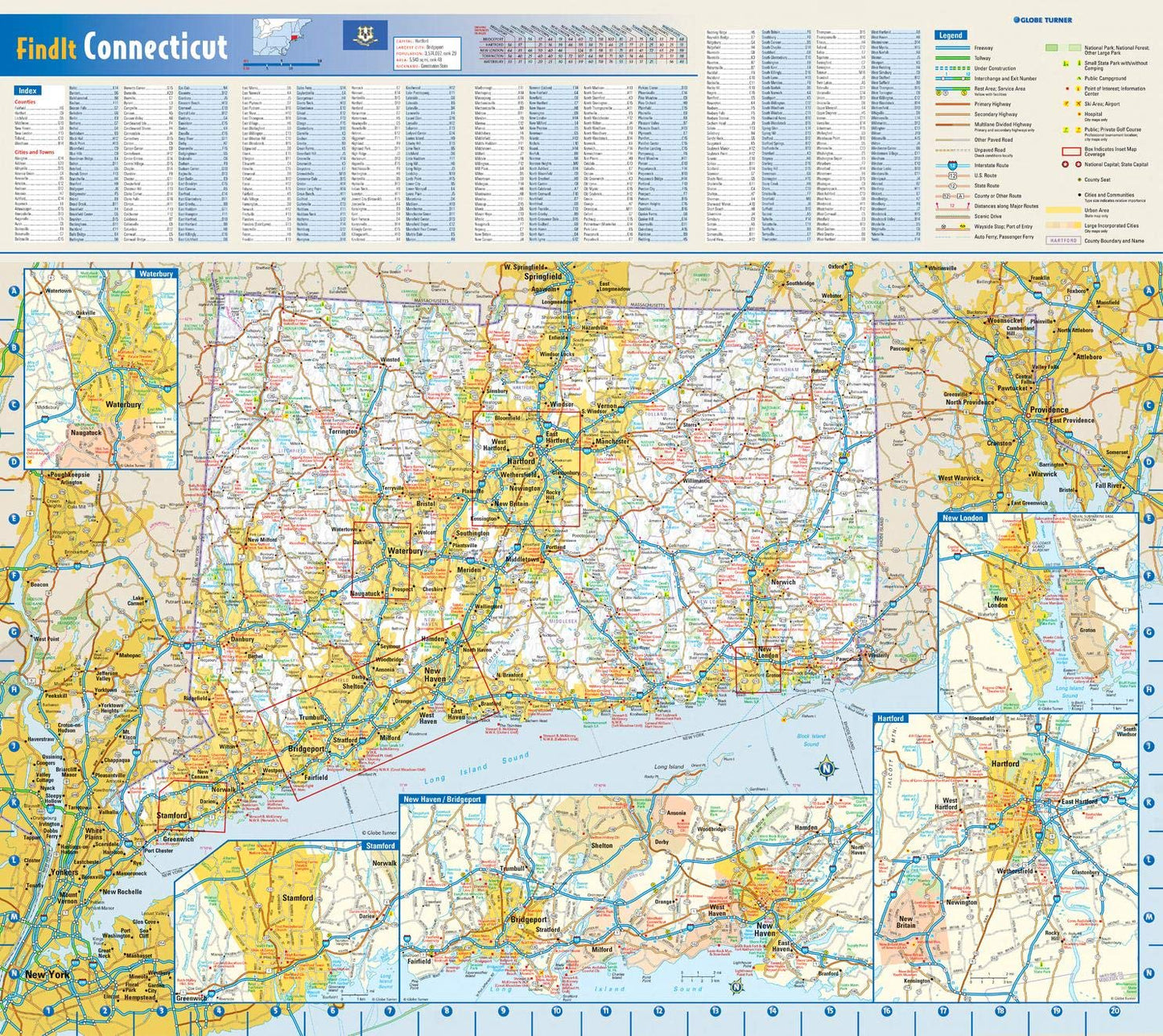
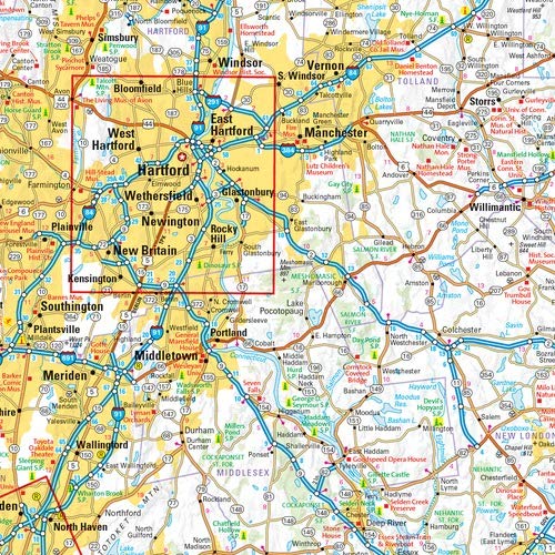
20.75 x 18.5 inches. Laminated. Flat map, tubed for shipping.
This colorful, easy-to-read state map of Connecticut identifies all major thoroughfares, secondary roads, freeway interchanges, rest areas, distance markers, landmarks, recreational areas, and more. Shaded relief on the state map provides a three-dimensional sense of Connecticut's topography. Detailed city inset maps of Hartford, New Haven-Bridgeport, New London, Stamford, and Waterbury are based on the latest street information from our cartographic experts. County and city indices make it simple to locate even the smallest town.
Created by Globe Turner, one of the leading producers of map products in the USA.
Share